More rain is headed to California, starting Feb. 14 in the San Francisco Bay Area, but forecasters say it might not be as bad as the last storm that caused flooding and killed at least 12 people.
One to 2 inches of rain could fall throughout Southern and Central California starting this weekend, and heavy snow could make driving impossible in the Lake Tahoe region, according to forecasts by the National Weather Service (NWS).
Meteorologists are still trying to pin down where the atmospheric river storm will land.
“It’s all about where the storm is going to settle,” NWS meteorologist Ryan Kittell told The Epoch Times. “There’s still a range of outcomes, in terms of timing and amounts.”
If the storm settles just off the Central California coast, it could deliver long periods of steady rain, but some projections show it could stay over the sea, dropping much of the precipitation into the ocean, Mr. Kittell added.
Either way, the rain should hit the Los Angeles region Saturday night or Sunday, and continue through Tuesday.
“The storm is coming,” he said. “It will be in the neighborhood, but just how close it will get to us is the big question mark.”
The weather service in Oxnard, which forecasts for Los Angeles, Ventura, and Santa Barbara counties, is concerned about potential flooding and mudslides in the region. With the ground saturated by the last monster storm, it wouldn’t take much rain to cause problems this weekend, Mr. Kittell said.
In San Diego, Orange County, and the Inland Empire—including Riverside and San Bernardino counties—the storm is forecast to produce rain starting Sunday evening, according to NWS meteorologist Adam Roser.
“It doesn’t look as big as the other storms, or anything like that,” Mr. Roser told The Epoch Times.
San Diego should see less rain from this system, while Orange County and the Inland Empire will get more of a soaking. The system could cause localized flooding, Mr. Roser added.
In Monterey, California, on the Central Coast, light rain was expected to start Wednesday and taper off that night or Thursday morning, according to the NWS.

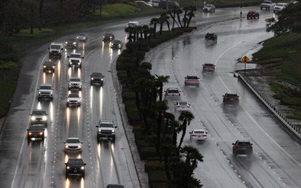
Cars drive through heavy rain in Newport Beach, Calif., on Feb. 5, 2024. (John Fredricks/The Epoch Times)
The Bay Area and the Central Coast should get a break on Friday before the second half of the system arrives on the weekend, meteorologist Roger Gass told The Epoch Times.
The region should see only about 1 inch of rain in the lowlands and 2 inches on coastal mountain ranges.
The weekend storm system could drop as much rain on the region as the last atmospheric river storm, but it will be spread out over several days, according to Mr. Gass.
“The rivers are expected to rise, but it would be a slow occurrence,” he said.
A winter storm warning was issued Wednesday for the Sacramento and South Lake Tahoe area until Thursday evening. Heavy snow was expected with accumulations of 12 to 18 inches above 6,000 feet and 2 feet of snow above 7,500.
The heaviest snow accumulations were expected Wednesday night into Thursday, dropping 1 to 2 inches per hour, according to the NWS.
Travel on local roads and into Lake Tahoe on I-80 over Donner Pass, I-50 over Echo Summit, and Highway 88 over Carson Pass could be very difficult to impossible, the weather service reported.
Wind gusts reaching 50 miles per hour were also in the forecast.
“Gusty wind could bring down tree branches,” NWS said in the warning.


