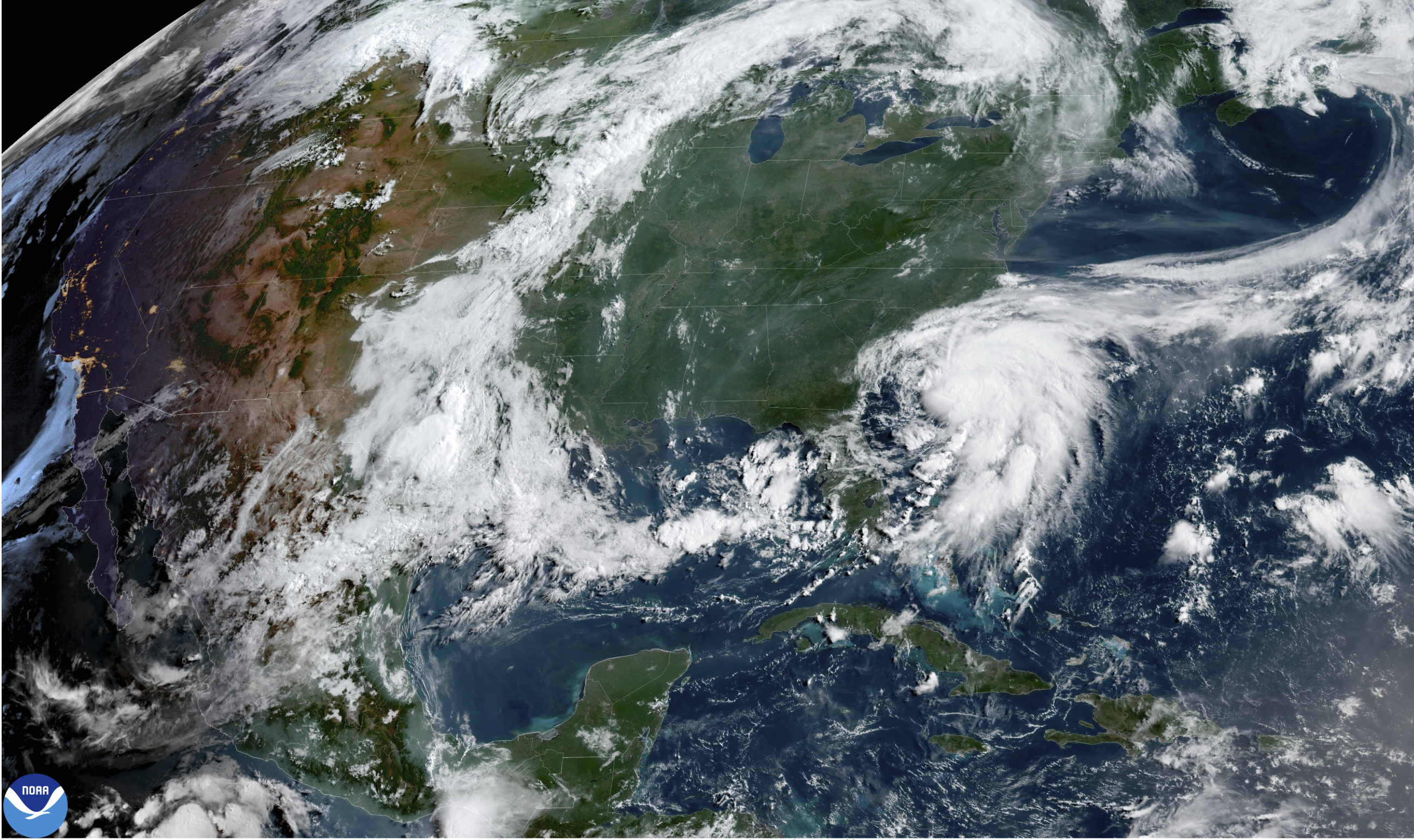


Tropical Storm Chantal made landfall near Litchfield Beach, South Carolina, early Sunday morning, bringing with it heavy rains as it moved inland across northeastern South Carolina and into Eastern North Carolina.
By 11 a.m. ET on July 6, the National Hurricane Center (NHC) announced that Chantal had weakened significantly into a tropical depression, and all tropical storm warnings previously issued for parts of North and South Carolina were discontinued.
However, the center said the “flash flood threat continues as rainbands move across central and eastern North Carolina,” with heavy rain lasting through July 7.
“Storm total rainfall of 2 to 4 inches, with local amounts up to 6 inches, is expected. An elevated risk for flash flooding will continue,” the center’s advisory stated. “ An isolated tornado or two is possible today over parts of eastern North Carolina.”
Chantal was roughly 70 miles east of Charleston, South Carolina, as of 5 a.m. on July 6, and 85 miles southwest of Wilmington, North Carolina. With maximum sustained winds of 50 mph, the storm was moving northeast at 8 mph.
Within the following six hours, it crossed the state line, remaining on its northeasterly track, increasing speed slightly to 9 mph. Its maximum sustained winds decreased to 35 mph, dropping below the 39 mph minimum requirement to be called a tropical storm.
The NHC expected the depression to continue north throughout July 6 and make a more easterly turn later over eastern North Carolina through the night.
The center also said, “Additional weakening is expected during the next 24 hours, and the system is expected to degenerate into a trough of low pressure” on July 7.
South Carolina’s Emergency Management division warned residents of potential isolated tornadoes along the coast and possible coastal flooding. The division also told drivers to avoid going out onto water-covered roads or near road-closure signs in places that are flooded.
Stormy Conditions for Carolina Coast
Tropical Storm Chantal’s anticipated landfall triggered tropical storm warnings and watches for nearly all of South Carolina and southern parts of North Carolina’s coastline.
At the 8 a.m. advisory update on July 6, the NHC reported that tropical-storm-force winds were extending outward up to 80 miles, mainly over water to the southeast of the storm’s center of rotation. The Coastal Research and Monitoring Program buoy just off Sunset Beach, North Carolina, reported a sustained wind of 33 mph with a gust of 47 mph.
Famous vacation spots including Myrtle Beach, South Carolina, and Surf City, North Carolina, were expected to face tropical storm conditions.
The NHC still warned during its July 6, 11 a.m. advisory that “life-threatening surf and rip current conditions” were expected to continue not just for the Atlantic beaches of the Carolinas, but for a swathe of the Southeast from northeastern Florida to the Mid-Atlantic state for “the next day or so.”
The NHC said that its 11 a.m. advisory will be its last about Chantal.
Chantal is the third named storm of the 2025 Atlantic hurricane season.
The Associated Press contributed to this report.