SISKIYOU COUNTY, Calif.—The removal of four dams and the loss of three reservoirs on the Klamath River, which flows through Oregon and Northern California, have increased wildfire risks, some local residents say.
But while firefighting plans have changed to account for the absence of the Copco and Iron Gate lakes and the John C. Boyle dam reservoirs, the California Department of Forestry and Fire Protection (Cal Fire) says that won’t hamper firefighting efforts in the region.
The Copco and Iron Gate lakes together held about 45 billion gallons of water, and firefighters drew more than a million gallons from Iron Gate lake to fight the Klamathon fire, a massive fire that threatened Ashland, Oregon, and the Cascade-Siskiyou National Monument in 2018, according to the Siskiyou County Water Users Association.
Copco Lake, California, resident Chrissie Reynolds, a board member of the association which opposed the dam removals and whose family owns two once-lakefront cabins, told The Epoch Times the water crisis in the Klamath region has become a “matter of life and death” because of the wildfire threat.
“If the government is allowed to take our water, then people will die, animals will die, and land will burn,” said Reynolds.
Agencies working with the Klamath River Renewal Corporation, a nonprofit in charge of the Klamath River Dam Removal Project, seeded new vegetation in the reservoir footprint this spring.
Reynolds said she fears that as it grows, the new vegetation will bring new risks of wildfires.
“When it was a reservoir, there was zero chance of that catching on fire,” she said. “What used to be a fire break is now a fire hazard.”
Some residents are skeptical of the renewal corporation’s fire management plan, and say they are also afraid that without the dams, they won’t be able to get fire and flood insurance for their homes and businesses due to increased wildfire risks.
With the reservoirs drained and the river too shallow for scoop planes, they’re further worried the deeper holes in the river floor have been filled in with sediment as a result of the dam breaches, making it more difficult for helicopters to draw water to put out fires, and they wonder how fire crews will deal with wildfires in the future, Reynolds said.
For more than 25 years, residents have voiced concerns that the agencies responsible for the dam removals have “kicked down the road” their questions, which are still not being answered “in real time,” Reynolds said.

Copco Lake resident Chrissie Reynolds fears increased wildfire risks could threaten her home and her family’s once-lakefront cabins on the near the Klamath River. (John Fredricks/The Epoch Times)
Wildfire Fears
At his ranch near the former Iron Gate Dam, William Simpson, a commercial helicopter pilot, told The Epoch Times aircraft drawing water from the reservoirs helped save the Cascade Siskiyou National Monument in 2018 from “total incineration.”
But now, scoop planes and helicopters may have to fly longer distances to fill their water tanks and buckets, he said.
“There’s nowhere you can draw water with a chopper and a bucket. That option is gone now,” said Simpson, who said he was recruited by Cal Fire as volunteer technical advisor during the Klamathon fire six years ago. “What happens if we have another fire there or somewhere else? Where do we get water to fight the fires?”
The Klamathon fire burned more than 60 square miles forcing about 3,000 people to evacuate.
Cal Fire indicates two helicopters, 350 personnel, 12 engines, and eight bulldozers or water tenders were assigned to the fire and that “numerous firefighting air tankers from throughout the state” flew fire suppression missions.

William Simpson at his ranch near the former Iron Gate Dam on May 9, 2024, says the loss of reservoirs on the Klamath River means less accessible water sources for water scooper planes and helicopters to fight wildfires. (John Fredricks/The Epoch Times)
KRRC Response
Klamath River Renewal Corporation spokeswoman Ren Brownell declined multiple requests for interviews about the dam removal project but responded to a written inquiry about wildfire risks and the corporation’s fire management plan.
Brownell said in an Aug. 13 email to The Epoch Times that the corporation is implementing all elements of its fire management plan and is working closely with California and Oregon fire protection agencies.
Brownell said the corporation consulted firefighting professionals and coordinated extensively with these agencies to develop the plan “with the goal of ensuring dam removal would not cause a net reduction in fire-fighting resources and that fire ignition risk would not increase” during or after the dam demolitions.
Fire protection agencies in both states endorsed the plan following a “quantitative modeling analysis of incremental fire risk,” concluding the plan was accurate and that additional resources provided were sufficient to address long-term fire risk in the Klamath Basin, she said.
When asked about the loss of the reservoirs and the problem of the free-flowing river being too narrow and shallow for water scoopers, she said the river will instead provide “multiple opportunities for firefighting helicopters.”
The plan requires the renewal corporation to maintain six aerial access points along the three previous reservoir sites—two at each—that Type 1 helicopters can use, she said.

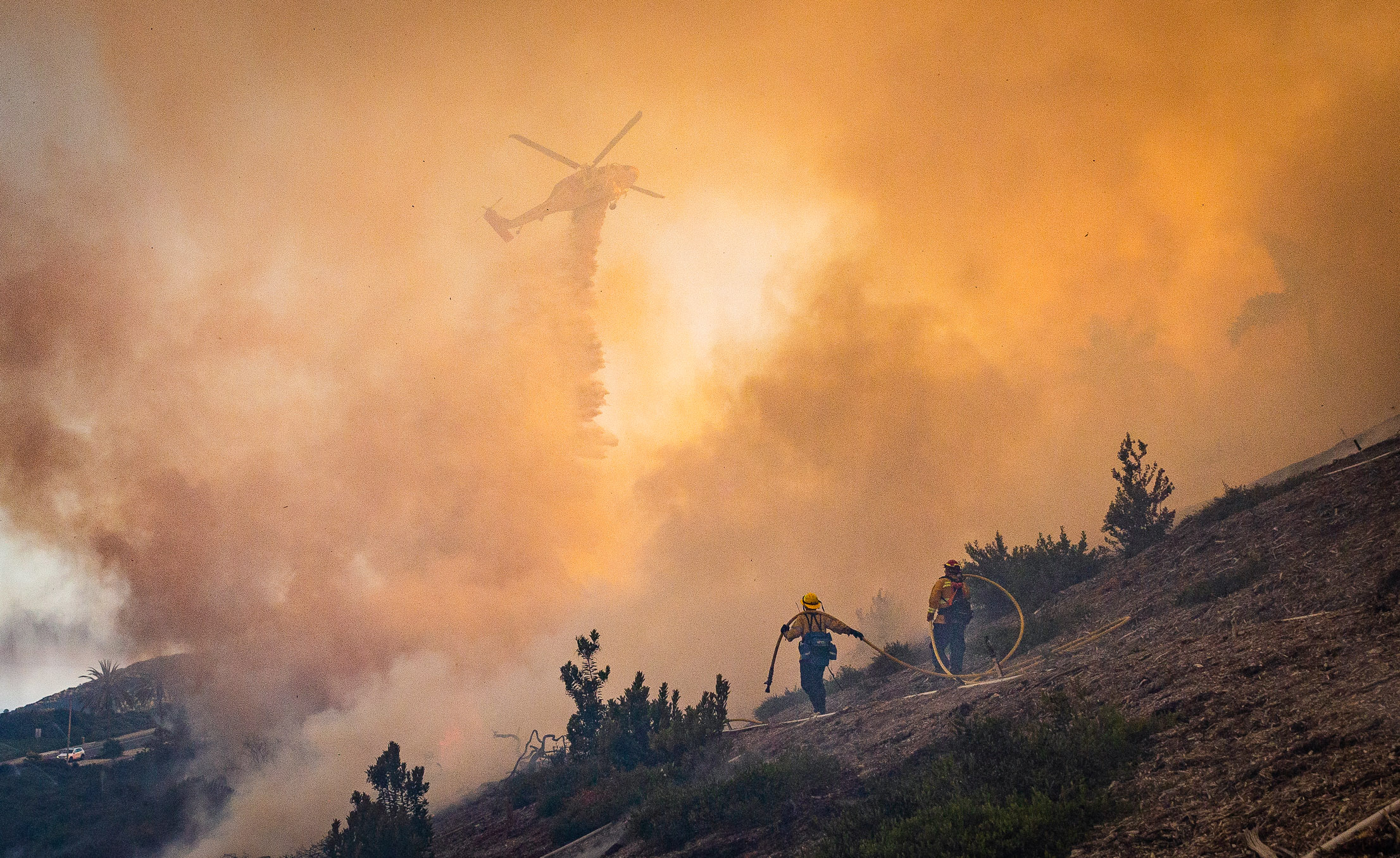
A Type 1 helicopter drops water in this 2020 file photo. (John Fredricks/The Epoch Times)
Type 1 helicopters typically carry about 700 gallons of water or retardant in a bucket or a snorkel that fills an internal tank, and are the “largest, fastest flying and the most expensive helicopters used to fight wildfires,” according to the National Interagency Fire Center, a large campus in Boise, Idaho where state and federal agencies pool resources in order to cut costs and coordinate fire suppression and planning efforts.
California and Oregon fire agencies chose the sites based on river channel conditions, including depth and width needed for helicopters, Brownell said.
The corporation spent about $1.6 million to expand firefighting capacity on the 2,200 acres of land that was uncovered when the reservoirs were drained, she said.

A Cal Fire Type 2 helicopter draws water from the golf course at Menifee Lakes Country Club to extinguish a brush fire in Menifee, Calif., on June 20, 2023. These helicopters, which are smaller than the Type 1 aircraft, typically carry about 300 gallons of water, according to the National Interagency Fire Center. (Brad Jones/The Epoch Times)
Cal Fire Helicopters
Benjamin Berman, the Cal Fire helicopter program manager and chief, told The Epoch Times that although the reservoirs are gone, Hawk helicopters are equipped to draw water from shallow pools within a free-flowing river with special snorkels and pumps as long as pilots can submerge the pumps sufficiently below the water surface to fill their buckets.
“The tank aircraft can get down into areas where you only need 18 inches of water, lower a snorkel and be able to draw water,” he said. “You don’t necessarily have to scoop the bucket like you would like in a larger body of water.”
Cal Fire still has the tools for timely and effective aerial fire suppression using different techniques, Berman said.
“A free-flowing river is not going to negate our ability to do helicopter aerial firefighting,” he said.
The primary mission of the agency’s helicopter program, Berman said, is to launch an aggressive initial attack on wildfires.
“Our job is to keep the fires to 10 acres or less 95 percent of the time,” he said. “That’s our bread and butter.”
If the wildfire spreads, an “incident command,” or fire management team is established, and that’s when contract aircraft, such as scoop planes, are brought in to battle the blaze, he said.
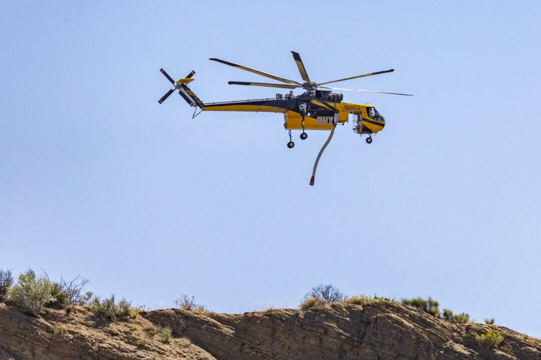
A firefighting helicopter works to clear the post fire burning outside of Gorman, Calif., on June 17, 2024. (John Fredricks/The Epoch Times)
Sediment Worries
Although some residents are concerned sediment—which washed downstream when the dams were breached—has filled in the deeper holes in the river floor, making it difficult for pilots to find deep enough pockets, Berman said helicopter pilots regularly draw water from irrigation ponds in farmers’ fields and orchards that contain “lots of sediment.”
“The pumps are not affected too much by muddy water and sediment,” he said. “We pull from [agriculture] ponds all the time.”
But while reservoirs provide ample water, deeper pockets could be closer to a fire depending on its location. So, if a reservoir is the only water source and is farther away than accessible pockets in the river, it would mean longer turnaround times getting back and forth to a blaze, he said.
Scoop Planes
Cal Fire doesn’t have its own fleet of scoop planes and the U.S. Forest Service manages contracts for these larger aircraft, Berman said.
Some scoop planes can hold up to 1,600 gallons of water and can skim from water sources, usually lakes, that are about 6.5 feet deep and 300 feet wide, according to the National Interagency Fire Center.
The Viking Canadair 515 water bomber, for example, requires a water source that is nearly a mile long but can skim a lake’s surface. According to manufacturers of the aircraft, it can scoop 1,600 gallons of water in 12 seconds, giving it an advantage over larger air tankers that must land on a paved runway to be refilled with fire retardant.
The very large air tankers that usually carry fire retardant are not amphibious and must land on a paved runway at a large airport. It would take about an hour to fly back and forth from Medford, Oregon, to the site of the Iron Gate dam and nearly two hours to Sacramento and back, Simpson said.
Fire Management Plan
The Klamath River Renewal Corporation’s
fire management plan outlines several steps that were taken to offset the loss of the reservoirs related to wildfire risks within a 570-square-mile aerial fire suppression area.
Some of these precautions included installing boat launches and dry hydrants along major roads near the river and streams, where ground crews can hook up pumps. In addition, the plan called for early fire detection cameras, portable dip tanks that can be set up to hold hauled water in areas where water sources are scarce, and dip sites that are to be maintained in the river for helicopter crews.
The plan acknowledges the loss of the reservoirs will make it harder for helicopter pilots to retrieve water and will increase overall haul times, but describes those concerns as “minimal.” It notes “the narrowness and invariable winds” in the river canyon can also make the task more difficult.
The river was expected to easily erode silt and clay from the reservoirs, rapidly moving the suspended sediment downstream so it wouldn’t settle and fill in pockets in the riverbed that provide deep enough pools for aerial firefighting crews, according to the plan.
A June 2021 memo from River Design Group, an environmental management consulting service, concluded that although the reservoirs provided “a broad fuel break to halt wildfire spread” the free-flowing river would still provide a fire break. It also said dry grasses from revegetation growth in the reservoir footprints were expected to pose a low fire risk in the first year or two.
“When vegetation is fully established, the Klamath River will continue to function as a fuel break, albeit a narrower one than the reservoirs,” the memo states.
In a Jan. 2021 letter from Cal Fire to Kimberly D. Bose, Secretary of the Federal Energy Regulatory Commission, Cal Fire Director Thomas Porter approved the fire management plan, writing it would not adversely affect Cal Fire’s ability to provide “adequate and effective firefighting capability in Siskiyou County and beyond.”
Dry Hydrants
Simpson, the commercial helicopter pilot, photographed dry hydrants below the former Iron Gate dam in early July, and said their design and locations are flawed and will result in what is known as air-cavitation, which can occur when suction is applied at the hydrant head. He compared the problem to trying to drink a milkshake from a straw with the straw partially out the cup or not in it at all.
“It’s just common sense,” he said.
As of Aug. 12, at least one of the hydrants, which Simpson shows in an Aug. 6 video, was still non-functional, he said.
He said he previously interviewed Fresno Fire Battalion Chief Michael Alforque, who helped fight the 2018 fire. In a video posted on YouTube, Alforque said the Iron Gate Lake was an “invaluable resource” to fight wildfires.
An unabashed critic of the dam removals, Simpson pointed out in a mid-July email to the Siskiyou County Board of Supervisors—obtained by The Epoch Times—that some of the dry fire hydrants weren’t functional.
“Why did it take a civilian to timely point out the glaring flaw in the dry fire hydrants installed by KRRC on the Klamath River designed to replace the lost lake water to fight wildfire?” he asked in the email.
At least one of the hydrants was fixed on Aug. 14, according to Simpson and other residents.
“It was broken for almost five weeks in the middle of fire season, exposing us to unnecessary risk that could have cost lives or loss of property,” Simpson said. “There is no excuse for that.”
Dip Sites and Revegetation
Siskiyou County Supervisor Ray Haupt, a professional forester and firefighter who worked for the U.S. Forest Service for 33 years—including as a district ranger in the Klamath area before retiring in 2010—told The Epoch Times he is doubtful that much of the river is deep enough for helicopters.
“I can only go from what I’ve been told from some of the river guides that are telling me how shallow the pools are now compared to where they were historically,” Haupt said.
And, he said, the portable dip tanks that the renewal corporation says can be deployed to remote locations, where water is unavailable, take too long to set up to be very effective when a blaze is sparked.
“Portable dip tanks are great for extended attacks—not initial attacks, he said. “It takes hours to set these things up, and that’s probably not at the critical stage when you need water right away. The best way to fight a fire is knock it down quickly. You can’t take several hours to set up a dip tank.”
Seeding native grasses in the dry lakebed on either side of the river also presents a risk of typically fast-moving grass fires, according to Haupt.
“Native grasses, by definition, go dormant in the summer. They dry out, and then they’re available to carry fire so there’s a threat of fire ... that was never there with the lakes,” he said.
Changes in the crops cultivated in the area can also affect the risk of fire. Some fields left fallow in Scott Valley, about 45 miles downstream of the former Iron Gate Dam, pose new risks of fires the region has never experienced because farmers are switching from grain to alfalfa due to state-imposed water restrictions on farmers and ranchers in the Scott and Shasta River watersheds.
Haupt said he is also concerned the Klamath Dam Removal Project could be used as a national model without sufficient critical analysis of its long-term effects.
“If you’re going to use it as a model, wouldn’t you want to wait until you figure out what it did before you do it somewhere else?” he asked.
Dam removal projects are being pushed by environmental groups, some native American tribes, and the politicians who support them across the United States.
Since 1912, 2,119 dams have been removed in the United States, including more than 180 in California, according to American Rivers, an environmental group that tracks dam removal trends and maintains a national dam removal database.
Last year was a “major milestone year for dam removal in the U.S.” affecting 79 other dams aside from “the initiation of the largest dam removal project in the country on the Klamath River,” according to American Rivers.
Public Policy Institute of California also reported more than 100 dams in California were demolished over the three decades leading up to 2019.
The Dam Removal Process
According to Haupt, the dam removals could have been done in a way that would have limited environmental damage, but, he said, “pretty much everything” the county and the community suggested “was ignored” by the Klamath River Renewal Corporation’s decision-makers, a 15-member board with nine members appointed by California and Oregon governors.
“We, as a county, spent $1.2 million interjecting science,” but the renewal corporation chose not to remove heavy mud and clay sediment in the bottom of the reservoirs before breaching the dams, he said.
The county had no say in the matter.
Renewal corporation CEO Mark Bransom said at a press conference in February that 5 million to 7 million cubic yards of sediment were expected to travel downstream during the drawdown, and that the project was going according to plan.
But Haupt says the corporation could have first drawn down the reservoirs and then removed the drier sediment bottom as the water receded, rather than breaching the dams and allowing so much sludge to flow downstream.
“They decided to do it the cheapest way, and the cheapest was the most destructive,” he said. “I’ve never seen [men] take on a project and do something so destructive when there was mitigation that could have been done for this.”
He said he is dumbfounded, because removing sediment before dam removals has been a common practice in other Federal Energy Regulatory Commission projects.
But Brownwell, the renewal corporation spokeswoman, said in an Aug. 16 email to The Epoch Times that the decision to send sediment downstream was made by federal agencies, including the U.S. Geological Survey and the Bureau of Reclamation—not the corporation—and was considered the “best approach” from both an environmental and cost perspective.

The free-flowing Klamath River meanders through the footprint of the Copco Lake reservoir on May 9, 2024.
Forest Management
Republican Congressman Doug LaMalfa, who represents the region and fought against the dam removals for more than a decade, is concerned the loss of the reservoirs will impact firefighting efforts and that with the decline of logging in the region, the U.S. Forest Service is “constantly blocking off access roads” to the backcountry, making it even more difficult for firefighter ground crews to get into some areas, he said.
Today’s forest management practices that fail to clear dry underbrush from forest floors are allowing nature to create a massive tinder box it will use later to cleanse itself by fire, he said.
“And, when nature finally does put the lightning strikes ... in those areas then it will be a severe purge,” LaMalfa said.

Dense forests with trees that each consume as much as as 250 gallons of water as day, and dry undergrowth create a tinder box for wildfires, say critics of today’s forest management policies. (Brad Jones/The Epoch Times)
Haupt, who owns a forest and natural resources consulting business and holds a degree in Natural Resources Management and Forestry, said one of the most overlooked problems related to wildfires and water shortages is there are simply too many trees.
“If you look at every tree out there ... using 250 gallons of water per day on 75 percent of the watershed, don’t you think that’s where you ought to be looking for more water?” he asked.
Haupt is a member of the Sustainable Forest Action Coalition, a grassroots coalition that seeks to restore an economically sustainable ecosystem on public lands through the “proper” management of watersheds, forests, and logging. He has worked with Congress on natural resources legislation and also conducted a research study, published in 2014, with the University of California-Merced and UC Berkeley, on the Sugar Creek watershed—a sub-watershed of the Scott River—which focused on changes in vegetation in the region since 1935.
Between 1977 and 1985, the region experienced a wet spell that allowed more trees to grow on lands with thinner soils, increasing the forest density to four times as many trees per acre than there were in 1935, Haupt said.
“And then we started into a dry period, which was more normal for California, and those trees started to die,” he said. “And, they’re really dying now because we’re at the height of this dry period.”
While “everybody wants to blame climate change” for the increase in wildfires, Haupt said bad forest management policies are also a factor.
“I’m not going to say there’s not climate change. There is climate change; it changes all the time. I can’t do anything about that as a forester. I can’t control the weather. I can’t control the heat of the fire itself, but I sure as heck can control the amount of fuel, and that’s what needs to be done,” he said. “The amount of fuel and number of trees per acre and the brush underneath them need to be reduced. It’s just a scientific fact.”
Public lands have been subject to litigation from environmental groups for the past 30 years, which has “diminished the effectiveness of the vegetation programs in the national forest at a time when the public lands really needed to be thinned, ” he said.

The Bond fire, burning in Silverado Canyon, Calif., on Dec. 3, 2020. (John Fredricks/The Epoch Times)


