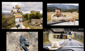

California ranchers say an online map that shows the approximate locations of GPS-collared wolves is a step in the right direction but lacks real-time tracking and accuracy to be truly effective.
The California Department of Fish and Wildlife (CDFW) introduced its “Wolf Tracker” feature on its website in mid-May. The automated wolf location mapping system is available to the public and shows the approximate location of GPS-collared wolves across the state.
Ryan Walker, president of the Siskiyou County Farm Bureau, told The Epoch Times that ranchers have for many years asked the state for as much real-time location data on wolves as they can get to protect both their livestock and livelihoods.
“For a long time, CDFW—through some sort of hyper-paranoid sense that we were out to get the wolves—would not share that information ... or it took a while to get to us,” Walker said. “It was frustrating.”
The online map is updated more slowly, and the data is less precise than ranchers had hoped, but it’s better than nothing, he said.
“There’s a lot of data we don’t have for sure, and so you take what you can get,” he said. “We’re getting some pretty good data once a day. It’s something.”
CDFW usually programs the GPS collars to collect three locations from dusk to dawn, when wolves are most active, and a fourth point at midday, to conserve battery life on the collars. The collars collect location data to transmit to CDFW each morning, but transmission sometimes fails or is delayed because of weather conditions or dense forest cover, according to the agency.
The location data is automatically transmitted to the online map, which shows individual wolves as a hexagonal cell. When clicked, it provides information about the wolf’s pack, the general area it’s in, and the last transmission date.
California’s Wolf Population
Katie Talbot, a CDFW spokeswoman, told The Epoch Times there are currently 10 wolf packs in the state and a total estimated population ranging from 50 to 70. Of those, she said, 14 are collared.
“We collar as much as we can. It’s a feat, but it’s super important and we’re dedicated to doing it,” Talbot said.
The maps won’t show locations of wolves near known den sites where wolf pups are believed to be, nor data points for wolves that leave the state, she said.
Although the map is available to the public, it’s mainly intended to help livestock producers understand the wolves’ movement and mitigate wolf-livestock conflicts, according to CDFW.
The agency acknowledges that to protect wolves from poachers, the map does not show the exact or current location of collared wolves and was never intended to show real-time data.
“California’s rural livestock producers living near wolves have faced real challenges as the wolf population grows in California,” CDFW Director Charlton Bonham said in a statement. “This is one more tool in our shared toolkit to protect their herds from wolf-livestock conflict.”
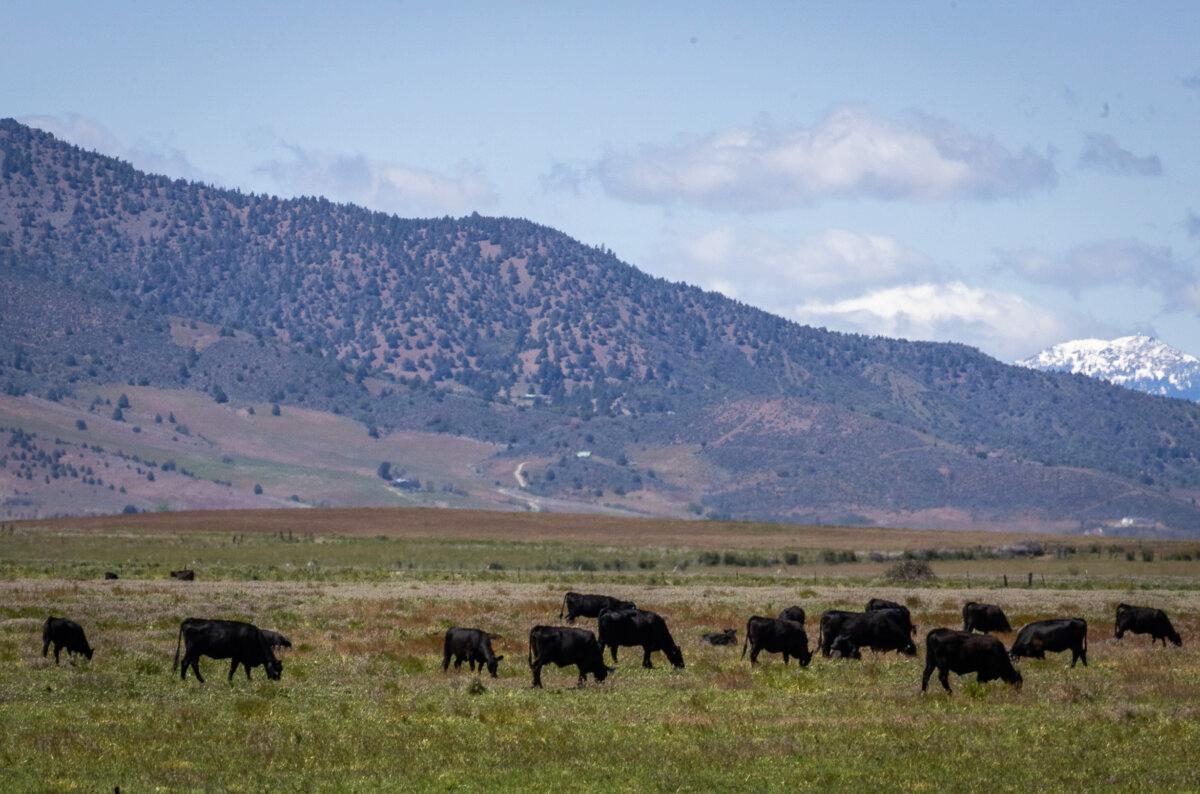
Cattle graze a pasture at Cold Springs Ranch in California’s Siskiyou County on May 7, 2024. (John Fredricks/The Epoch Times)
Wolves Killing Cattle
Siskiyou County has seen more kills by wolves than any other county in the state, and Table Rock Ranch has been the hardest hit. Since November 2021, wolves have killed at least 44 head of cattle, rancher Janna Martin Gliatto told The Epoch Times. Of those confirmed wolf kills, three were adult cows, and the rest were calves.
Many ranchers have “really changed their tune” about wolves and now realize how easily they can become habituated to preying on cattle, she said.
“At first, a lot of people were like, ‘Oh wolves, isn’t that so sweet?’ ... and they really didn’t know how severe the impact was going to be,” she said. “I mean, it’s so crazy.”
Most of the kills have been attributed to the Whaleback Pack, which now has three collared wolves, including the alpha male, a breeding female, and a younger female offspring.
Siskiyou County Wolf Liaison Patrick Griffin told The Epoch Times that while the mapping system shows some recent data, he still does his best to notify ranchers when wolves are near their cattle.
“It’s good in some ways, but it’s not very precise, and it can’t be precise because then everybody would know exactly where the wolves are,” he said. “So there’s problems.”
The map doesn’t show the collared wolves at their den site, and the Whaleback Pack’s den site blackout spans about 36 square miles with cattle ranches within it, Griffin said.
“Within that area, there’s not going to be any notifications unless they come from me, which I would get from the biologist,” he said.
If wolves are clustered in an area for several hours outside the den area, it usually indicates they’re feeding on some type of prey, and if the cluster is on or near a ranch, then he will notify the rancher, he said.
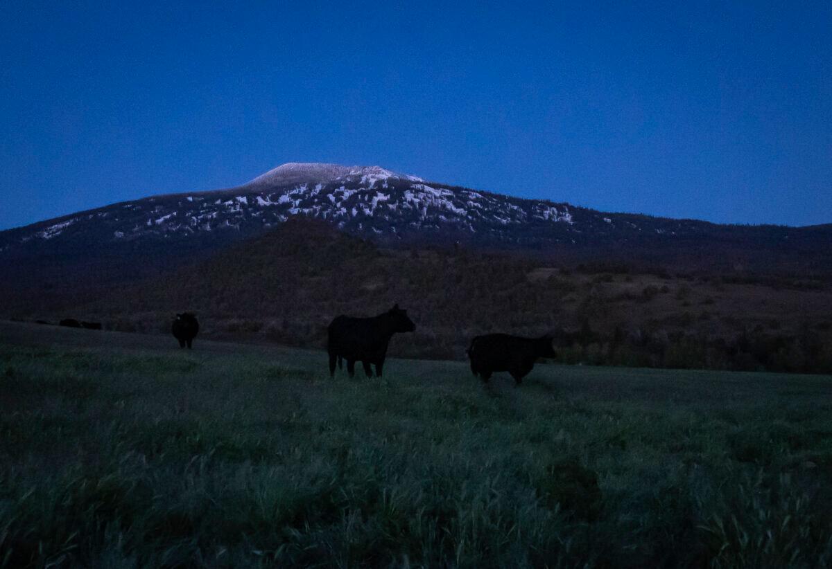
Cattle roam a pasture at Cold Springs Ranch in California’s Siskiyou County on the evening of May 7, 2024. (John Fredricks/The Epoch Times)
‘A False Positive’
Debbie Bacigalupi of Cold Springs Ranch told The Epoch Times that the new mapping system can give ranchers a false sense of security because it often shows no wolves or any movement for several days in a row.
While Bacigalupi says she’s happy when she doesn’t see any hexagon cells on the map, it doesn’t mean she or her parents can rest easy about wolves on their family-run ranch.
“There are plenty of other wolves that are not collared that could be on our ranch,” she said. “So it’s a false positive. We’re like ‘Yay, the wolves aren’t here!’ but they could be there any second.”
For example, she said, wolves were sighted on May 26 at Table Rock Ranch, which shares a fence line with her ranch, but those wolves weren’t shown on the map.
Walker said the Whaleback Pack has been “toggling back and forth” between the Table Rock area and Butte Creek for a couple of years.
When data shows the Whaleback wolves at Mount Hebron, Walker said, he’s comfortable, but if they start moving toward Willow Creek Mountain, then he might move his cows from his back range into the meadow where he can keep a closer watch on them, especially if they’re calving.
“We can’t afford to have range riders 24/7 with our cows,” he said. “I might just ride them more or ... I might go out and just shoot the gun up in the air a bunch of times, to see if I can scare [the wolves] away.”
While ranchers would “love for every wolf to be collared” and to always know where the wolves are, the state doesn’t have the will or the wherewithal to do that, Walker said.
Kirk Wilbur, vice-president of government affairs for the California Cattlemen’s Association, told the CDFW that as wolves increase in number and range, ranchers are “in dire need” of additional tools to protect their livestock.
“Knowledge is power, and this mapping tool will empower ranchers throughout wolf territory to better understand where wolves might threaten their livestock, enabling them to increase human presence and adjust their herd management as necessary to deter wolf attacks,” Wilbur said.
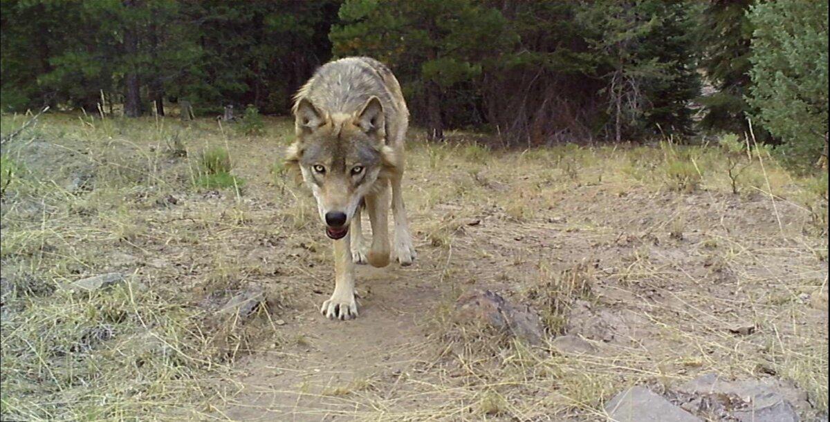
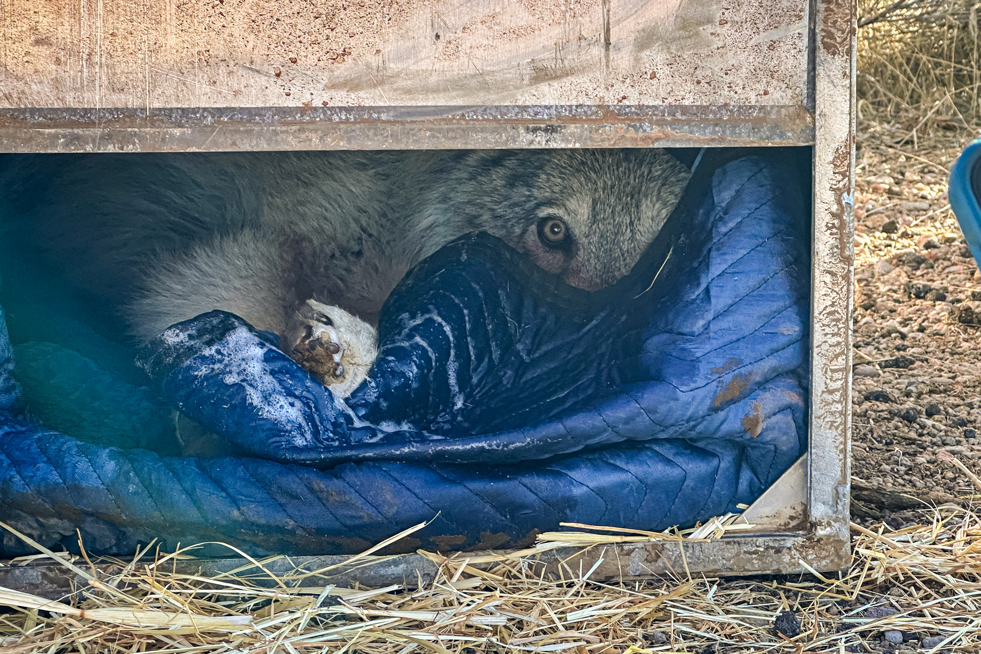
A gray wolf in Siskiyou County, Calif. (Courtesy of Patrick Griffin)
‘Wolf Hysteria’
Amaroq Weiss, an attorney and senior wolf advocate at the Center for Biological Diversity (CDB), told The Epoch Times that recent media coverage of wolves killing cattle has created “wolf hysteria,” especially among ranchers who are not used to coexisting with them.
CBD claims that in California, confirmed and probable wolf-caused losses in 2024 amounted to 0.009 percent of total livestock losses based on CDFW U.S. Department of Agriculture data from the National Agricultural Statistics Service (NASS).
The percentage is even less if one compares the NASS data showing an estimated 5.05 million cattle and 510,000 sheep in California as of Jan. 1, and the 163 confirmed wolf kills that CDFW has reported since 2011, Weiss said.
“Most Californians want wolves back on the landscape, and they’ll support ranchers who show they’re willing to coexist with wolves by proactively preventing conflicts,” Weiss said in a statement.
She said livestock-wolf conflicts are rare but that both ranchers and wolves will benefit if ranchers are given a “heads up” when wolves are in the area so they can act to protect their herds.
Although CDFW has not disclosed the size of the hexagons on the map, each hexagon represents an area of nearly 4.5 square miles, according to CBD.
While Idaho and Montana have long-established wolf populations of more than 1,000 each, Weiss said “they’re still only killing minute percentages” of livestock.
The map can inform responsible ranchers about when to increase prevention measures, such as deploying range riders and guard animals, removing livestock carcasses from the field, and using fence flags.
While some ranchers are losing cattle, others are adapting better to the wolf presence and aren’t experiencing wolf depredation, she said.
“I know ranchers in California who have been aware of this, and they have educated themselves, and they are not having losses,” Weiss said. “Ranchers are business people too, and the first rule of business is you change with the changing times.”
“Ranchers in California have known since 2011 the wolves were coming, and they’ve known for a decade that wolf packs were forming in the state,” Weiss said.
She said it’s not feasible to collar every wolf, but agencies try to collar one or two wolves in each pack.
“It’s important to not give out real-time information because wolves are under threat from people who will illegally kill them,” she said. “The poaching of wolves has risen astronomically on the West Coast, in Oregon and Washington. We’ve had mass deaths of wolves.”
“Wolves are listed as an endangered species under state and federal law. Except in the case of self-defense, the penalty for killing a wolf under federal law is up to one year in prison and a $100,000 fine,” she said of California.
CDFW warns that it may “modify or discontinue the tool if it results in the harm or harassment of wolves or other wildlife or trespassing on private property.”