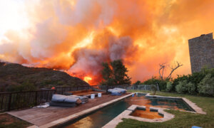
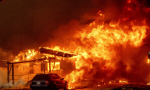
Three massive fires covered nearly 175 square miles in Southern California on Sept. 12 as hundreds of firefighters and National Guard soldiers continued battling blazes in four counties.
Cooler weather on the horizon, however, is expected to slow the progress on some of the more active fire areas in the Bridge, Airport, and Line fires.
Gusty winds that fueled extreme fire behavior in the Bridge Fire earlier this week died down Wednesday night, allowing firefighters to continue making progress building fire lines and mopping up burned areas, fire officials reported Thursday morning.
The fire’s burn area in Los Angeles and San Bernardino counties reached nearly 80 square miles on Thursday with no containment.
Fire officials expect cooler temperatures and higher humidity on Thursday and Friday, which could help slow the fire’s progress.
“Forecasted weather will assist firefighters in the fight today,” fire agencies reported Thursday morning.
The agencies reported that nearly 475 firefighters working on the fires, which started Sept. 8, will focus on the hard-hit Wrightwood community, one of the first communities to be evacuated Tuesday night, Pinon Hills, and Mount Baldy.
No injuries have been reported, according to Lisa Cox, a spokeswoman for the Bridge Fire.
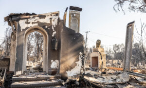
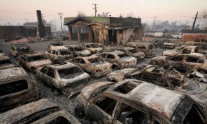
According to Cox, fire investigators are also unable to enter the areas hardest hit by the flames to confirm the number of homes or structures lost.
“We know there’s been impacts, but we do not have numbers yet,” Cox told The Epoch Times.
The Los Angeles County Fire Department reported during a Wednesday morning news conference that the fire had destroyed about 20 homes in the Mount Baldy area, 13 homes in the Wrightwood area, and six cabins in the wilderness areas of the fire zone.
However, those numbers were not official, Cox said. Investigators are using aircraft to assess some areas, but it could take several more days to determine exact numbers through ground inspections.
“We can’t confirm official numbers until we’ve been fed them officially, and we can’t get in there until it’s safe,” Cox said. “It’s going to take a few days.”
The cause of the fire remained under investigation.

California Gov. Gavin Newsom ordered National Guard troops to assist in fighting the Line Fire burning in San Bernardino County, Calif., on Sept. 12, 2024.
The Line Fire, which started on Sept. 5 and continues to scorch areas of San Bernardino County near Big Bear Valley, is 18 percent contained. By Thursday morning, it had burned 58 square miles.
Fire crews were getting help with 12 extra deputies and 26 National Guard members assigned to the Line Fire by Gov. Gavin Newsom.
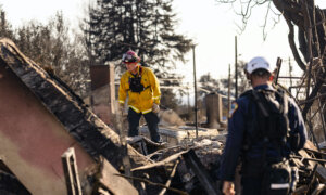
Inspection teams were working in the area this week to find any structures that may have been damaged or destroyed in the fire.
“Today, cooler weather and smoke shading will moderate fire growth,” the California Department of Forestry and Fire Protection (Cal Fire) reported on Thursday. “Fire established in drainages will still exhibit fire spread. Firefighters are building and strengthening control lines and mopping up hot spots.”
Farther south in Orange and Riverside counties, fire crews were working to contain the Airport Fire, which had grown to about 36 square miles on Thursday.

A helicopter flying above the Airport Fire near Trabuco Canyon, Calif., on Sep. 10, 2024. (John Fredricks/The Epoch Times)
Falling temperatures allowed firefighters to establish containment lines around 5 percent of the burn. Thursday’s temperatures in the fire area were expected to be about 78 to 80 degrees with light winds, according to the Cal Fire.
“The cooler weather brought reduced fire activity during Wednesday’s operations, reducing its intensity and lateral spread,” Cal Fire officials reported in an update on Thursday morning.
Six homes have been destroyed in the fire, while nearly 22,000 other structures remained threatened.
Two people and eight firefighters were injured.
Cal Fire’s Riverside County crew posted a video of one of their battalion chiefs saving a woman who was walking through the flames and strong winds of the Airport Fire. The video shows the woman in a long dress walking toward the fire chief’s vehicle.
“This incredible rescue shows the dedication and courage of our firefighters, who are working tirelessly to keep our communities safe,” the agency wrote on X Wednesday.
The fire was continuing to burn in Trabuco Canyon and Rose Canyon, about 25 miles southeast of Santa Ana. Agencies used aircraft throughout the day to drop water and retardant in key locations.

Firefighters monitor the Airport Fire from a ridge near Porter Ranch in Trabuco Canyon, Calif., on Sept. 10, 2024. (Paul Bersebach/The Orange County Register via AP)
Several areas in Orange and Riverside counties remained under evacuation orders, including the area just north of the San Diego and Riverside county line, while many other regions in both counties were under evacuation warnings.
Authorities closed several roads, including Plano Trabuco, Santa Margarita Parkway, Trabuco Canyon, Santiago Canyon, Live Oak Canyon, Ortega Highway, east of Quarry, and Grand Avenue in Lake Elsinore.


