
The northern United States was blasted with a mass of arctic air sweeping south from Canada and bringing heavy snow and dangerously low temperatures over the weekend as residents in the Pacific Northwest continue recovering from catastrophic floods that began hitting portions of Washington state on Dec. 11.
Thousands of people were forced to evacuate as floodwaters engorged the Snoqualmie River on Dec. 11, and one family’s rescue was captured on video after deputies from the King County Sheriff’s Office marine rescue dive unit freed them and their dog from a field half a mile in size that had been turned into a lake.
“It’s obvious that thousands and thousands of Washingtonians and communities all across our state are in the process of digging out, and that’s going to be a challenging process,” Washington Gov. Bob Ferguson said.
Forecasters said the region will likely get hit with another round of rain and wind by the evening hours on Dec. 14.
“Bottom line at this point in time is we’re not done despite the sunny conditions that we have across western Washington at this point,” said Reid Wolcott, a meteorologist with the National Weather Service in Seattle.
Wolcott said there is more to come in terms of wind, rain, and flooding.
“And Washingtonians need to be prepared for additional impacts, additional flooding, tree damage, power outages, etc.,” the meteorologist said, noting that further impacts could come late in the weekend and early this week as high winds risk toppling trees while the ground is saturated with rain.
Forecasters warned that the conditions affecting Washington state could affect western Montana and north-central Idaho from Dec. 15 through Dec. 17, bringing “moderate to heavy precipitation.”
Arctic Air Freezes Northern US
The National Weather Service said the mass of arctic air would bring “very cold and dangerous” windchills across a region stretching from the Northern Plains to the Ohio Valley on Dec. 14 before spreading into the mid-South and mid-Atlantic areas.
Forecasters also warned of a “swath of accumulating snow” affecting portions of the country from the Midwest to Central Appalachia on Dec. 14 before expanding into the mid-Atlantic region in the evening.
Areas of northeast Florida, south Georgia, and south Alabama are under freeze warnings from late in the evening of Dec. 14 into the morning of Dec. 15, according to the National Weather Service.
The weather service also issued an extreme cold warning for parts of central and east-central Illinois, including the cities of Champaign, Monticello, Charleston, and Shelbyville, beginning at 12 p.m. local time on Dec. 14 until 6 a.m. on Dec. 15, warning of “dangerously cold wind chills as low as 30 [degrees] below” zero.
The cold temperatures slammed the Northern United States on Dec. 13, bringing conditions of minus 12 degrees Fahrenheit to Grand Forks, North Dakota, where windchills made those temperatures feel closer to minus 33 degrees.
The National Weather Service forecast temperatures in the Minneapolis area to drop to about minus 15 degrees by early on the morning of Dec. 14, with Chicago expected to see temperatures of about 1 degree.
With the arctic air mass moving southeast over the weekend, the weather service expanded cold weather advisories to cities as far south as Montgomery, Alabama, where residents are forecast to see temperatures fall to about 22 degrees on the night of Dec. 14 and into the morning of Dec. 15. Similar temperatures, about 24 degrees, are forecast to affect Savannah, Georgia, during the same period.
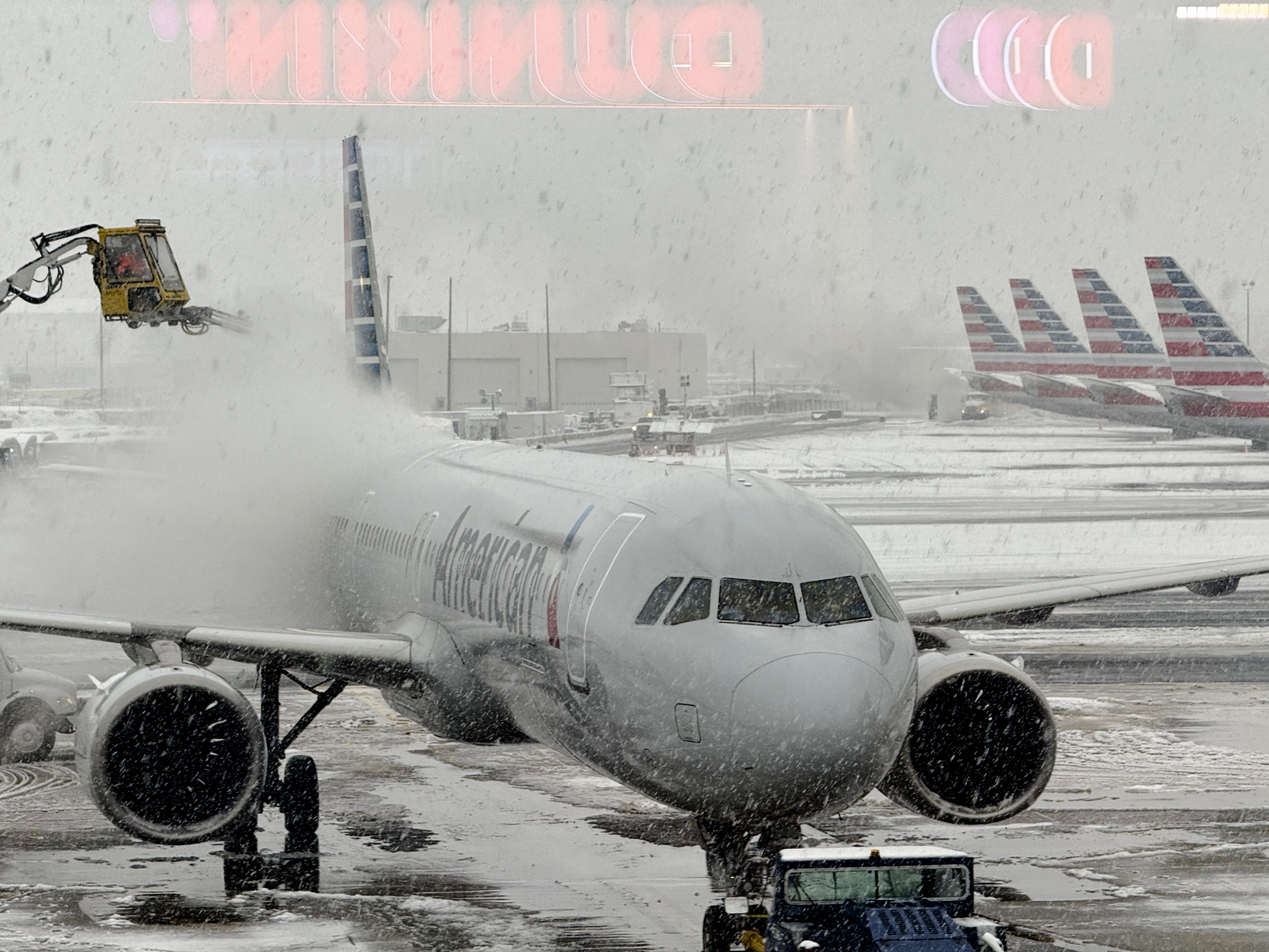
There were 1,344 flight cancellations within, into, or out of the United States as of 7:20 p.m. EST on Dec. 14, according to the flight tracker FlightAware. The three U.S. airports most affected by delays and cancellations all serve the New York City metropolitan area: LaGuardia Airport, Newark Liberty International Airport, and John F. Kennedy International Airport.
The Associated Press contributed to this report.